The latest on Winter Storm that will impact the Twin Cities this week
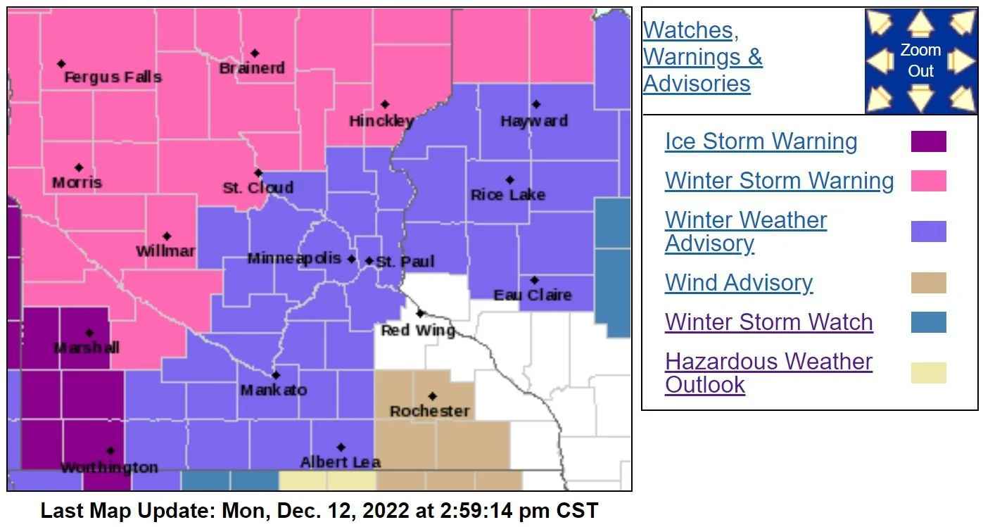
The National Weather Service in the Twin Cities has just issued a Winter Weather Advisory for the Twin Cities Metro (purple color in the image above) that is in effect from Noon Tuesday through Noon on Wednesday for mixed precipitation with a light glaze of ice and up to 3.0 inches of snow possible for parts of the Metro. We will go into more detail about that below.
The Winter Storm Watches that were to the north and west of the Metro have been upgraded to Winter Storm Warnings with a few areas to the southwest even under Ice Storm Warnings where upwards of a tenth to four-tenths of an inch of ice could be possible.
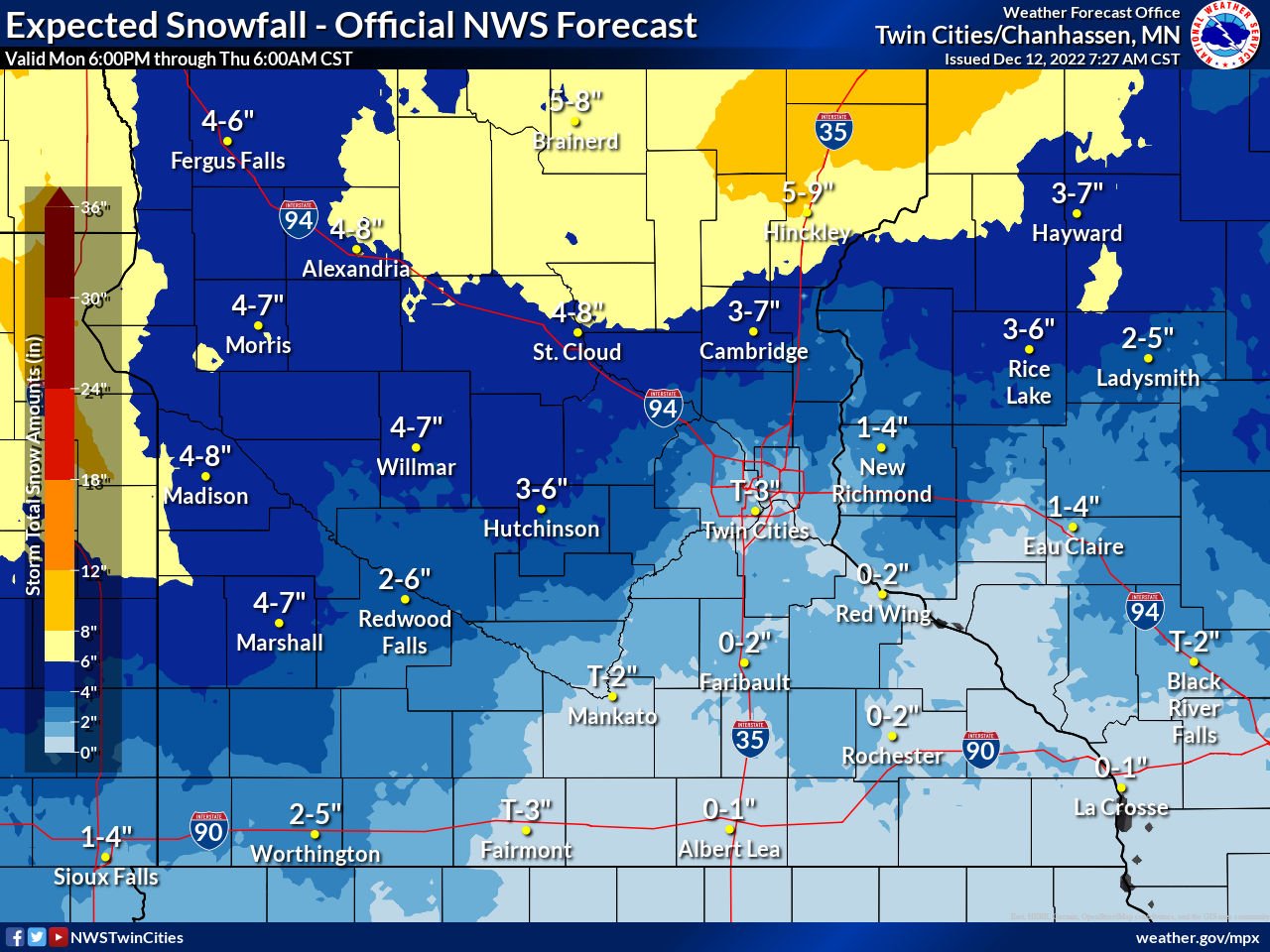
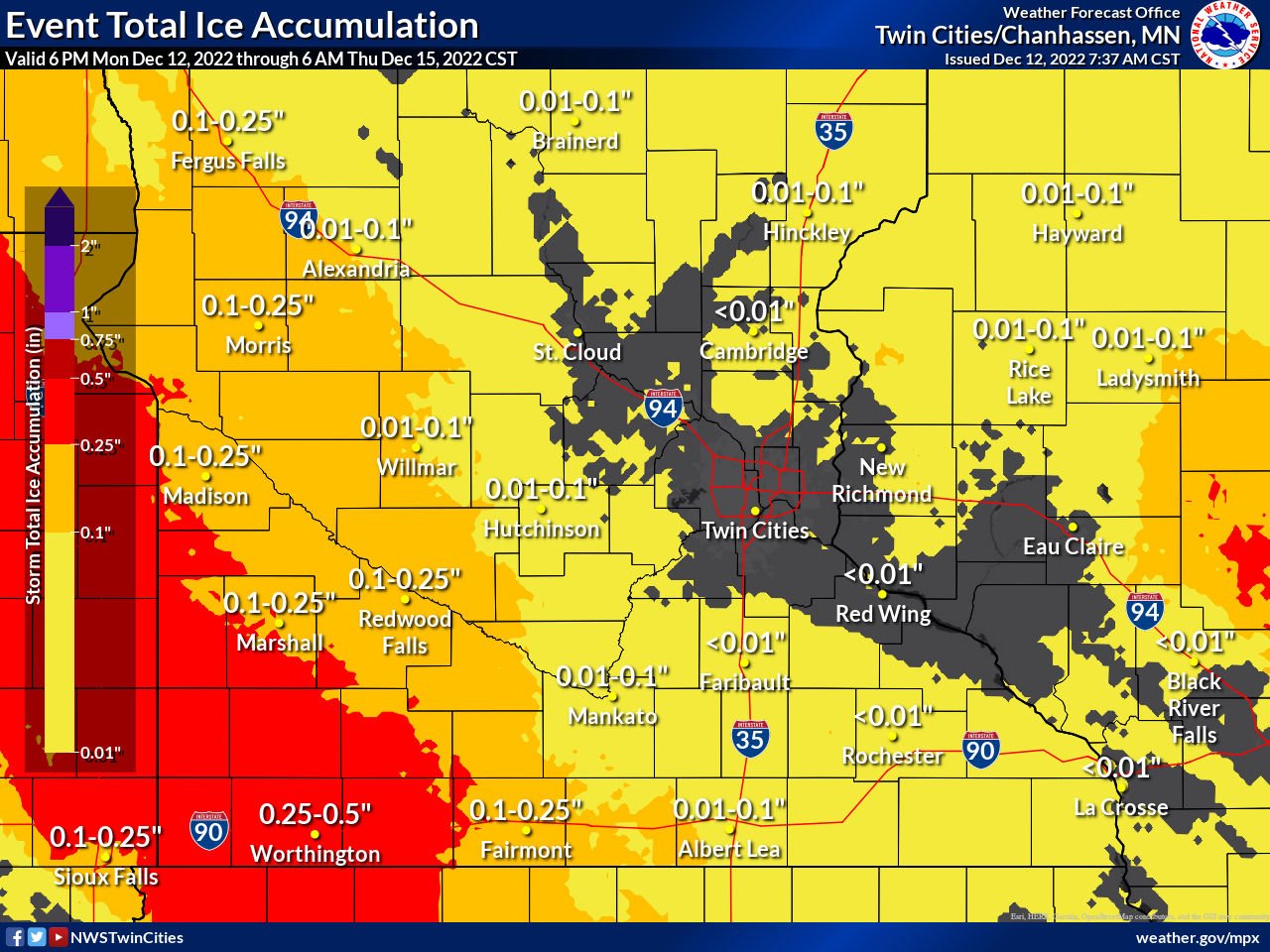
Above you will find the expected snowfall forecast from the National Weather Service in the Twin Cities from 6 PM Monday through 6 AM Thursday, along with the expected ice accumulation for the same timeframe from the National Weather Service in the Twin Cities. From the graphic above, the heart of the Twin Cities will likely see the lower end of the forecast for snow and likely won’t see over 1.5 inches of snow if that. I think temperatures will stay just warm enough to keep most of the Twin Cities on the rainy side of this event, while the suburbs to the north and west will likely see better chances for snow or mixed precipitation. Regarding the freezing rain or mixed precipitation, it appears the Twin Cities’ best chances for that would come late in the afternoon and into the evening hours as temperatures begin to decrease. If we do make the change over to some freezing rain, a glaze could be possible.
A small break in the action is still possible across the Twin Cities on Wednesday, before a return to some light mixed precipitation throughout the day. As cold and the remaining moisture wraps around the back of the low pressure system, the second round of this system will work across the Twin Cities late Wednesday into Thursday. This round is when we will see the best chance for snow through Saturday, with guidance still showing 3-6 inches being possible. Some pockets of locally higher amounts can’t be ruled out.
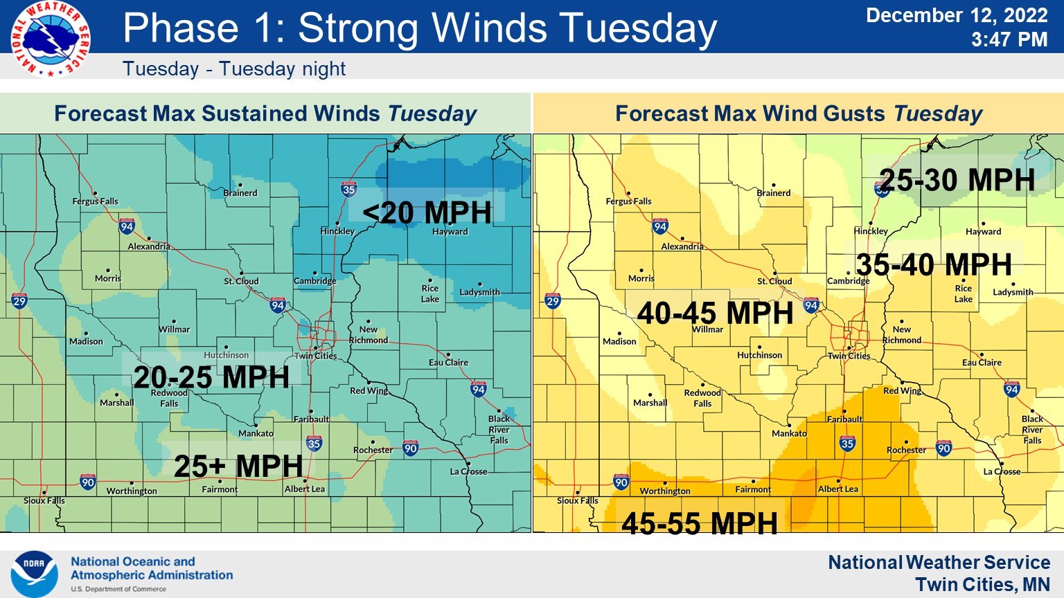
Winds will again be a big factor with this storm across the Twin Cities metro Tuesday into Wednesday, as this strong low pressure works across the region. Winds will be out of the south-southeast advecting both the warmer temperatures and moisture into this system from the south. Wind gusts could be in excess of 45 mph on Wednesday, so if you have Christmas decorations that are at risk of blowing away it is recommended that you tie them down or take them in.