
Winter Storm Watch is in effect for the Twin Cities ahead of blizzard conditions and dangerous cold
A potent winter storm is forecast to work across the Twin Cities region beginning Wednesday and into early Thursday bringing with it the potential for several inches of snow and wind gusts as high as 55 mph which will cause blizzard conditions. On the back side of this winter storm, dangerously cold air will surge across the region Thursday through Saturday which has the potential to bring life-threatening conditions and wind chills as low as -30 to -40 below zero. The heavy snow and strong winds could additionally cause trees to break and result in power outages across the region which could make the cold surge behind this system furthermore life-threatening as air temperatures drop below freezing in the coming days.
Major travel impacts are forecast across the region as whiteout conditions from the heavy snow and winds will likely cause very difficult to impossible travel. If you have travel plans, whether they are driving or flying late this week, it is highly recommended that you make the arrangements to adjust those travel plans now.
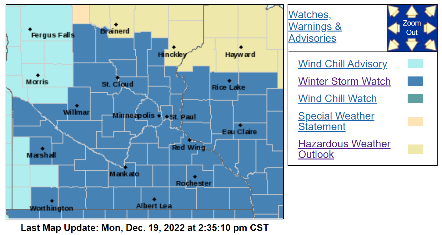
Below you will find the full details from the Winter Storm Watch that was issued by the National Weather Service in the Twin Cities just after 2 PM this afternoon.
WINTER STORM WATCH - TWIN CITIES

COUNTIES: Morrison, Mille Lacs, Kanabec, Benton, Sherburne, Isanti, Chisago, Hennepin, Anoka, Ramsey, Washington, and Dakota
...WINTER STORM WATCH IS IN EFFECT FROM WEDNESDAY MORNING THROUGH LATE FRIDAY NIGHT...
* WHAT...Blizzard conditions are possible. Total snow accumulations of 5 to 10 inches are possible. Winds could gust as high as 50 mph.
* WHERE...Portions of central and east central Minnesota.
* WHEN...From Wednesday morning through late Friday night.
* IMPACTS...Travel could be very difficult or impossible. Widespread blowing snow could significantly reduce visibility. Gusty winds could bring down tree branches. The dangerously cold wind chills as low as 35 below zero could cause frostbite on exposed skin in as little as 10 minutes.
* ADDITIONAL DETAILS...This could be a life-threatening situation if you get stranded traveling late this week. Consider adjusting any travel plans now.
PRECAUTIONARY/PREPAREDNESS ACTIONS...
Prepare for possible blizzard conditions. Continue to monitor the latest forecasts for updates on this situation