
Twin Cities region sees much-needed rain
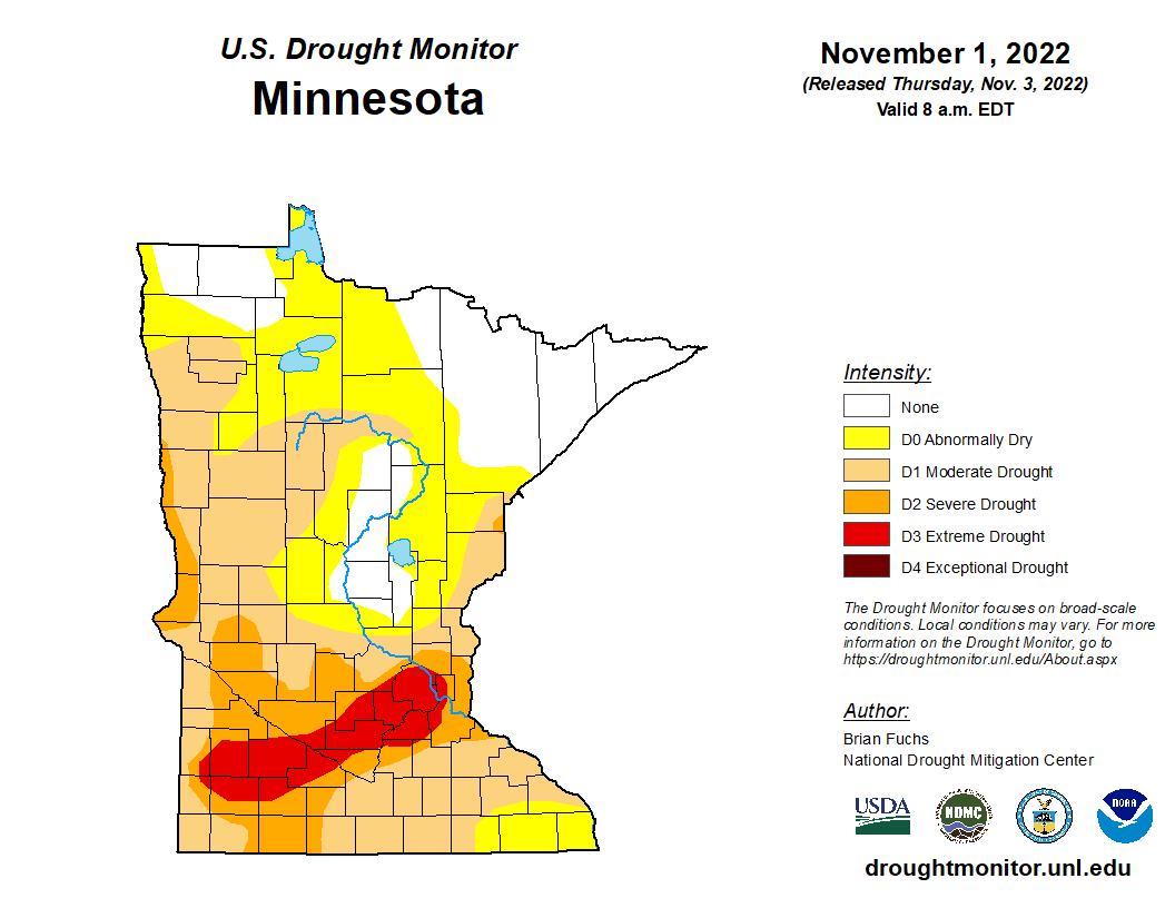
With a large portion of the Twin Cities region under Severe to Extreme drought, which you can see from the map above, the rain over the last few days is a site for sore eyes for many. According to the National Weather Service Twin Cities/Chanhassen, Minnesota climate report issued early Wednesday morning, the Twin Cities saw around 0.64 inches of rain so far this month, with 0.31 inches of that falling yesterday, November 8th. Since September 1st, the Twin Cities region has seen 1.12 inches, which is about 4.94 inches below the normal amount of rain we should be seeing this time of year. The normal amount is supposed to be around 6.06 inches.
Additional Relief, Severe Weather, and Snow Coming
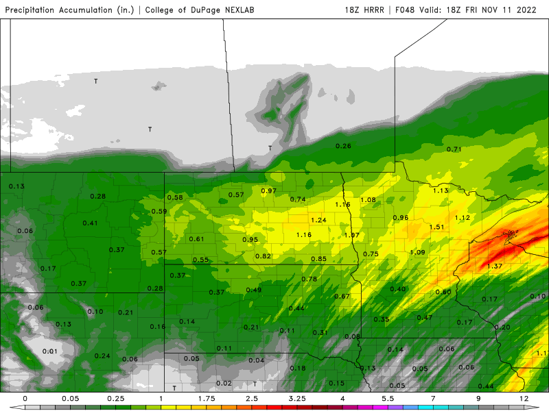
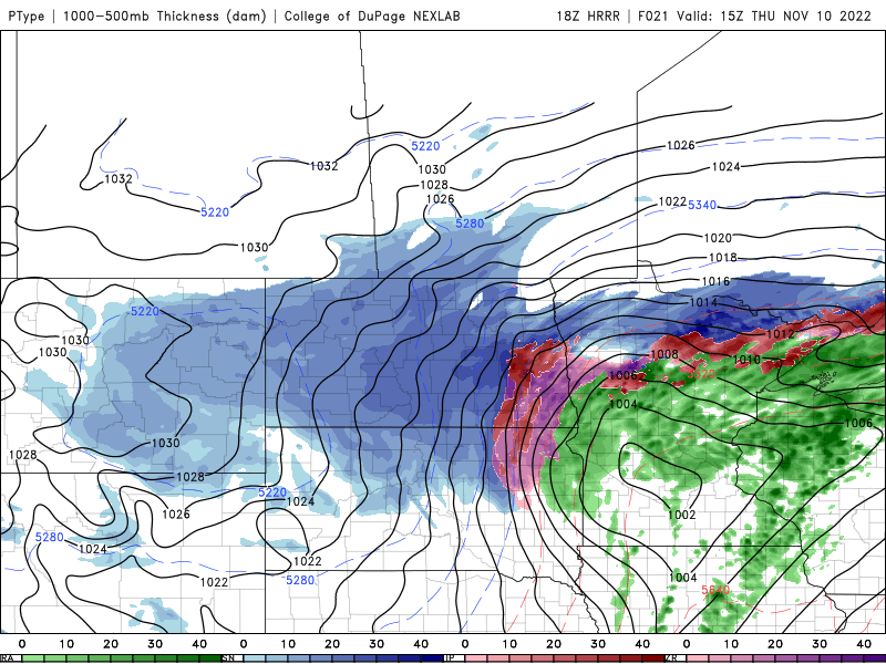
The latest model guidance continues to show an ongoing chance for showers and storms across the Twin Cities over the coming days. These rain and storm chances are all part of a strong area of low pressure works across the Upper Midwest bringing winter storm and blizzard-like conditions to the Dakotas and northern Minnesota and then rain and severe weather across central and southern Minnesota, Wisconsin, Iowa, northwest Illinois, Missouri, and Kansas.
Below you will find the latest Day 2 Storm Prediction Center Severe Weather Outlook for Thursday, November 10th. A marginal risk, (1 out of 5 chance,) and a slight risk (2 out of 5 chance) for severe weather are possible on Thursday as a cold front races across the region. Showers and storms are forecast to develop along and ahead of that front, with a few strong to severe storms possible. The main threat from these storms will be damaging wind gusts, but a brief tornado threat nd isolated large hail can’t be ruled out.
On the back side of this low pressure and after the cold front passage, temperatures are forecast to drop across the Twin Cities. Any lingering moisture behind the front could bring a chance for snow showers. Little to no accumulation though is expected at this time due to limited moisture and forcing.
