Winter Storm Warning is now in effect for the Twin Cities Metro
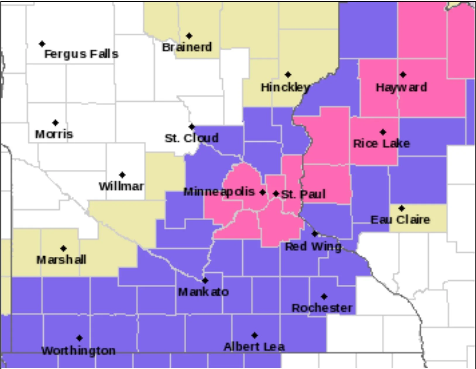
8:30 PM UPDATE, Monday, November 28th - The National Weather Service in the Twin Cities has upgraded the Winter Weather Advisory across the Twin Cities Metro to a Winter Storm Warning from 5 AM to 6 PM CST on Tuesday for 4-7” of snow. The Winter Storm Warning is in place for the following counties: Hennepin, Ramsey, Washington, Carver, Scott, Dakota, Polk, Barron, and St. Croix.
Original Story: The National Weather Service in the Twin Cities has canceled the Winter Storm Watch across parts of the far northeastern Twin Cities Metro and placed the entire Metro under a Winter Weather Advisory that goes into effect from 4 AM to 9 PM on Tuesday. The latest model guidance has 3-6” possible across the region, with many areas likely to fall in the 4-6” range across the immediate Twin Cities Metro.
Snow looks to begin in the far west-southwest Twin Cities Metro around 2 AM on Tuesday, with conditions deteriorating throughout the day as a heavier snow band sets up over the region. Snow looks to end around 8-9 PM Tuesday, with snow working out of the eastern Metro and into Wisconsin by that time. Where this heavier band sets up is where we will see those higher snow totals occur.
There remains some uncertainty with this dynamic system in terms of higher-end snow totals and how much moisture might be available. So there is still a chance that parts of the Metro could be upgraded to a Winter Storm Warning if confidence increases that 6”+ of snowfall could occur. If an upgrade does occur, we will be sure to update this post with the latest information.
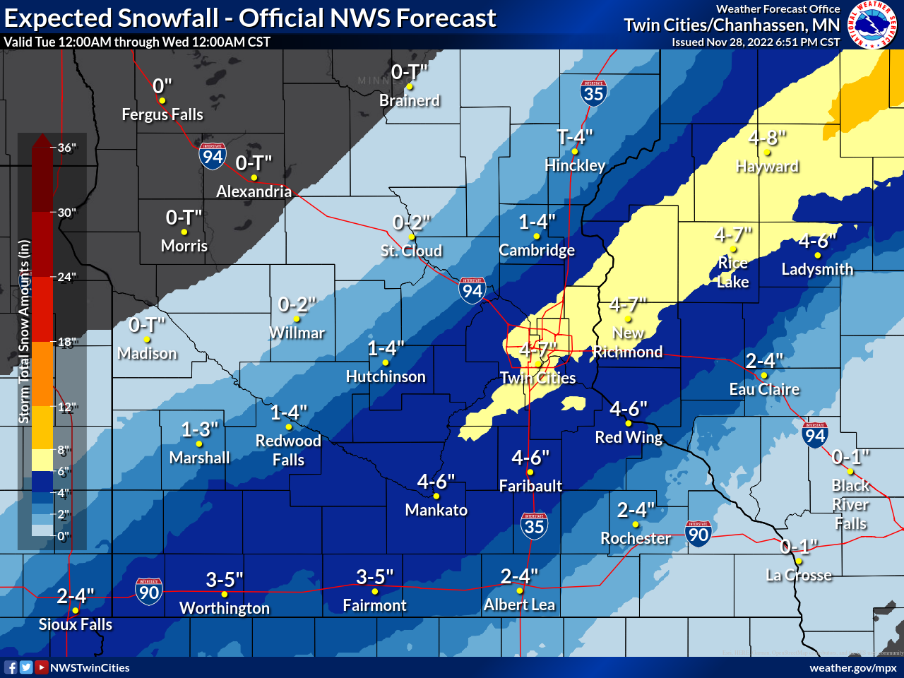
Below you will find the Official NWS Forecast of expected snowfall for the Twin Cities Metro from the NWS Twin Cities.
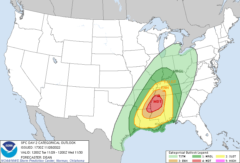
Southern Severe Weather Threat
While a winter storm is impacting the upper Midwest across the southern United States, a severe weather outbreak is forecast to occur with the threat of damaging winds, large hail, and tornadoes. Some of these tornadoes have the potential to be strong, long-track tornadoes.
Severe weather is forecast to develop Tuesday afternoon and continue into the late evening hours on Tuesday.