
Winter Storm Watch issued for Twin Cities, total snow accumulations of over 12 inches possible
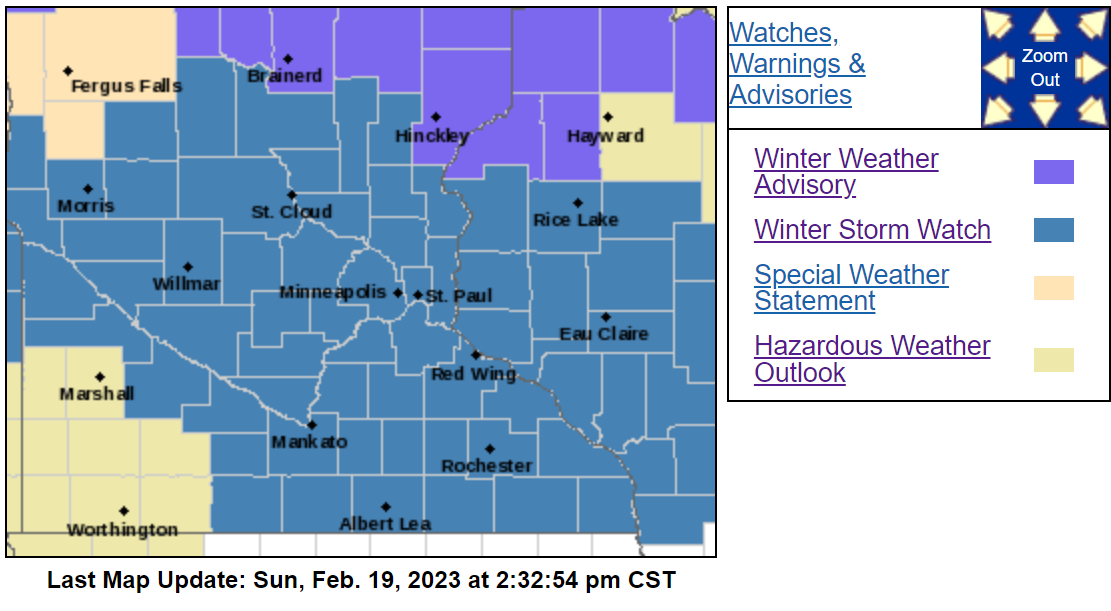
A WINTER STORM WATCH was issued for the entire Twin Cities region for heavy snow and blizzard conditions with wind gusts as high as 45 mph being possible.
COUNTIES: Douglas-Todd-Morrison-Mille Lacs-Kanabec-Stearns-Benton-Sherburne-Isanti-Chisago-Wright-Hennepin-Anoka-Ramsey-Washington-Carver-Scott-Dakota-Le Sueur-Rice-Goodhue-Waseca-Steele-Freeborn-Polk-Barron-Rusk-St. Croix-Pierce-Dunn-Pepin-Chippewa-Eau Claire-
 CITIES IMPACTED: Alexandria, Long Prairie, Little Falls, Princeton, Mora, St Cloud, Sauk Rapids, Elk River, Cambridge, Center City, Monticello, Minneapolis, Blaine, St Paul, Stillwater, Chanhassen, Chaska, Victoria, Shakopee, Hastings, Le Sueur, Faribault, Red Wing, Waseca, Owatonna, Albert Lea, Osceola, Rice Lake, Ladysmith, Hudson, River Falls, Menomonie, Durand, Chippewa Falls, and Eau Claire
WINTER STORM WATCH IN EFFECT FROM TUESDAY EVENING THROUGH THURSDAY AFTERNOON
* WHAT...Heavy snow possible. Total snow accumulations of greater than 12 inches possible. Winds could gust as high as 45 mph and lead to areas of blowing snow, blizzard conditions possible.
* WHERE...Portions of central, east central, south central, southeast and west central Minnesota and northwest and west central Wisconsin.
* WHEN...From Tuesday evening through Thursday afternoon.
* IMPACTS...Travel could be very difficult to impossible. Areas of blowing snow could significantly reduce visibility. The hazardous conditions could impact the morning or evening commutes. The cold wind chills as low as 20 below zero could cause frostbite on exposed skin in as little as 30 minutes.
* ADDITIONAL DETAILS...There will be two main waves of this event. The first Tuesday evening through Wednesday morning will see
totals of 4 to 8 inches of snow. There will be a lull before snow picks up again Wednesday evening where an additional 8 or more inches of snow could fall.
PRECAUTIONARY/PREPAREDNESS ACTIONS...
Monitor the latest forecasts for updates on this situation.