
Southern Wisconsin-Northern Illinois Severe Threat - June 13-14th
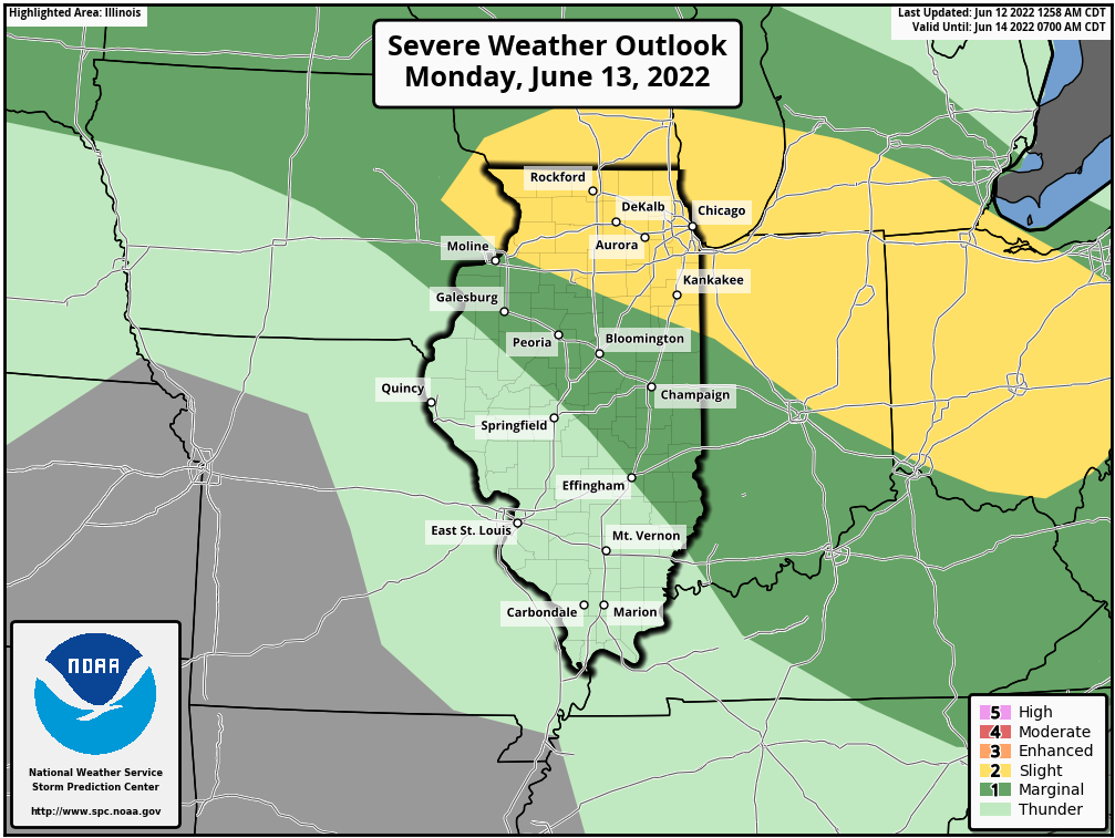
Similar to Minnesota, with an increase in heat and moisture, comes the threat of strong to severe storms. There continues to remain some spread in the models as to how the threat of severe weather might unfold late morning into early afternoon on Monday, but there is the potential for a more significant severe weather event developing across Southern Wisconsin and Northern Illinois.
[Tomorrow] Monday, June 13th
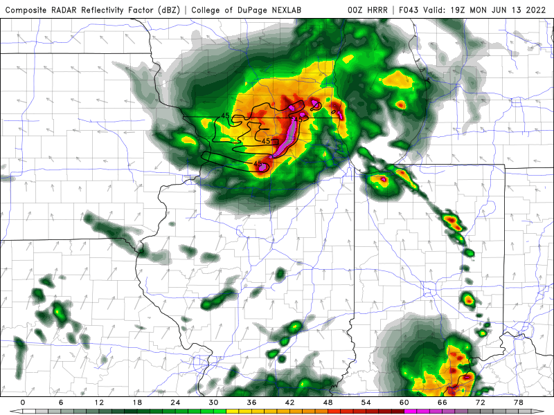
As hinted above, models will need to be monitored over the coming day or so before a location and timing can be better determined, but what is known, hot and humid conditions are forecast to work across the region beginning Monday setting the stage for ample instability that is forecast to develop to support the threat for potentially significant severe weather chances. At this time, it appears a cluster of showers and storms will work out of Minnesota and become better organized as they work east-southeast. It appears by late morning into early afternoon this cluster could become a bowing cluster by the time it reaches south-central Wisconsin to north-central Illinois. Below you will see an image from the 00Z HRRR around 2 PM on Monday with one possible solution. This cluster of storms could end up becoming a long-duration system that is otherwise known as a derecho, but again, we will know more over the next day or so.
The main threat from these storms will be damaging straight line wind gusts that could potentially be in excess of 75-80+ mph in addition to large hail, and heavy to very heavy rain which could lead to some localized flash flooding. If everything does come together for this potential severe weather event, YOU NEED TO TAKE THIS THREAT SERIOUSLY! This is NOT something you want to be caught outdoors or in a car driving in.
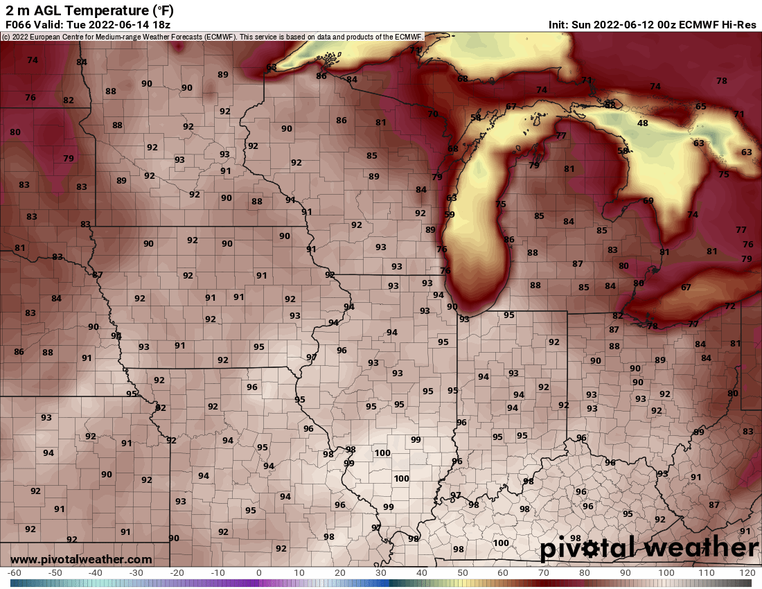
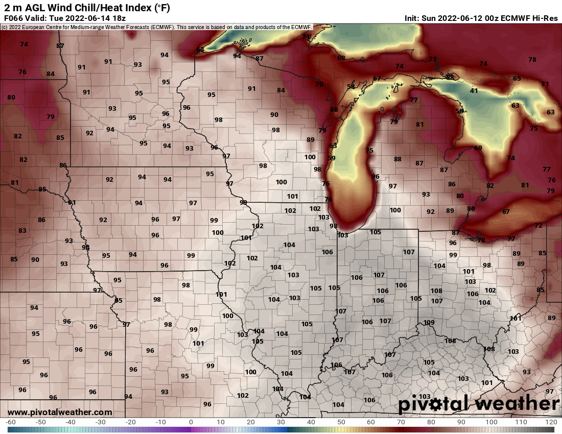
Toasty Tuesday - June 14th
Below you will find the forecast from the 00Z ECMWF model for high temperatures around noon on Tuesday followed by a look at the projected heat indices for Tuesday around noon. Temperatures are forecast to be in the middle 90s with heat indices in the low to mid 100s.
We will continue to monitor the threat of strong to severe weather over the coming days. Be sure to have a plan in place in case severe weather does develop, and remember to be weather aware!