
Twin Cities Severe Threat - June 12-14th
With an increase in heat and moisture, comes the threat of strong to severe storms. While there still remains some uncertainty in the overall coverage of the severe threat, models are starting to come to better agreement on the potential for severe weather beginning late Sunday night into early Monday, Tuesday afternoon and into the late evening hours, and lingering threat early Wednesday morning.
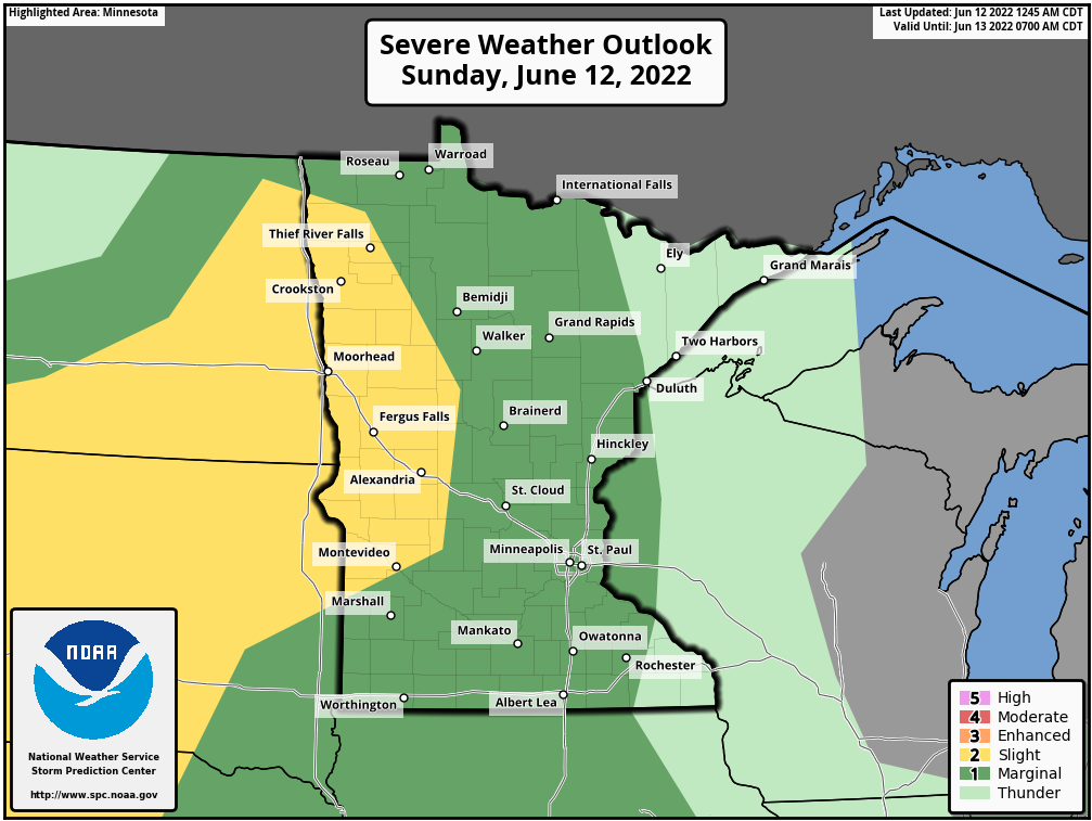
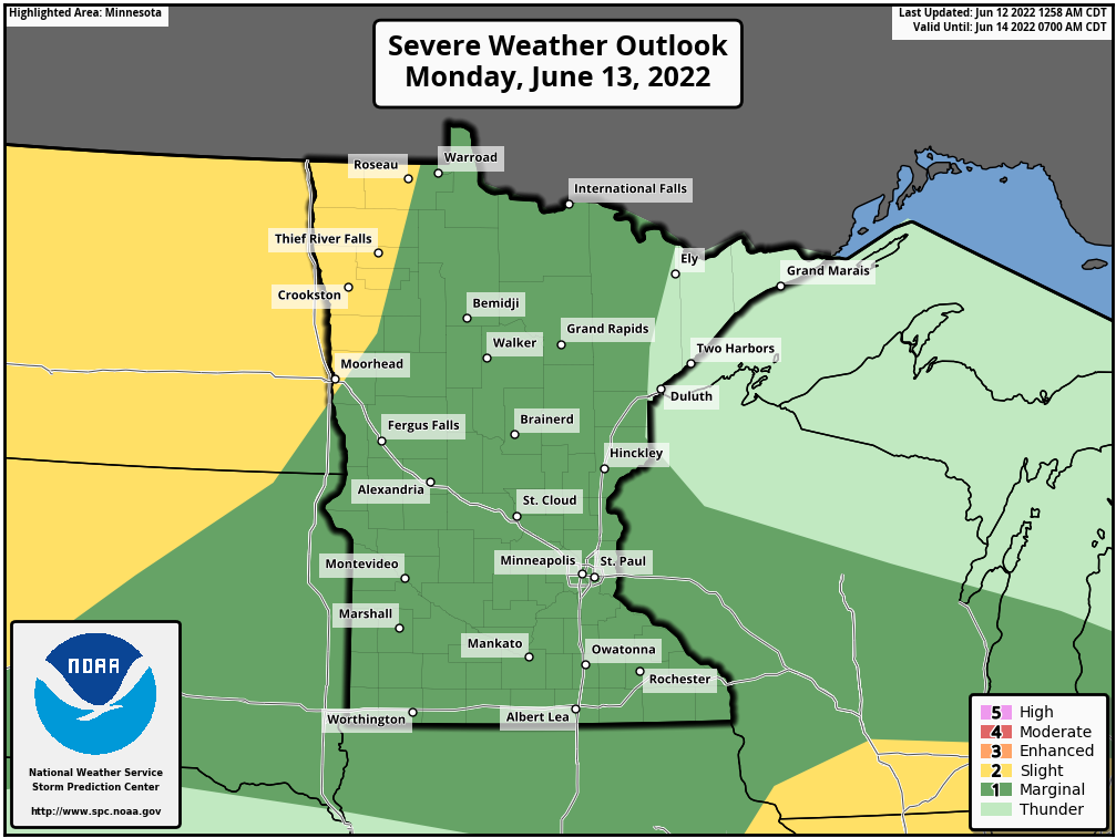
[Today] Sunday, June 12th into [Tomorrow] Monday, June 13th
Overall the severe threat today for the Twin Cities will be low as a cap will be in place for much of the day which will prevent storms from developing. There is a chance that a few isolated strong to severe storms could develop with damaging winds and large hail being the biggest threat from these. The greater threat comes late Sunday night into Monday morning as showers and storms are once again forecast to develop over the Dakotas and work off to the east-southeast. These storms look to arrive in the Twin Cities around early to late morning on Monday. Models have been consistent on a possible linear cluster of storms working into the Metro, but have varied in regards to the timing. So this will be something we are going to need to monitor throughout the day today.
In regards to the severe threat, large hail and damaging straight line winds look to be the greatest threat from these storms, but heavy rain could also be possible with these storms which could lead to some localized flash flooding.
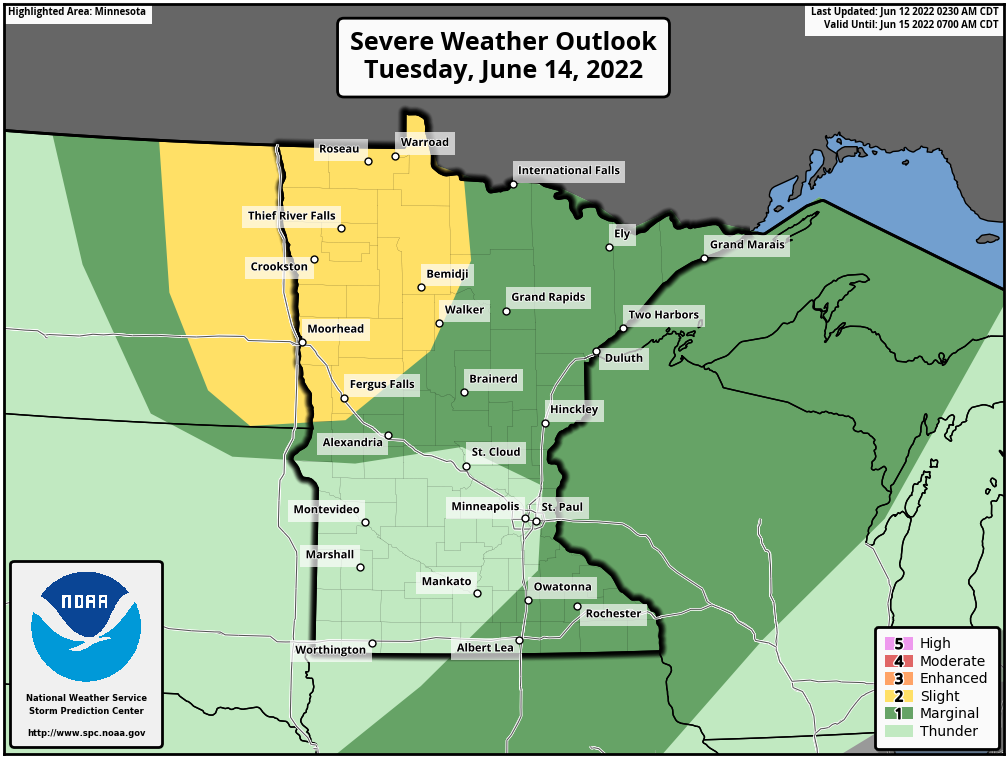
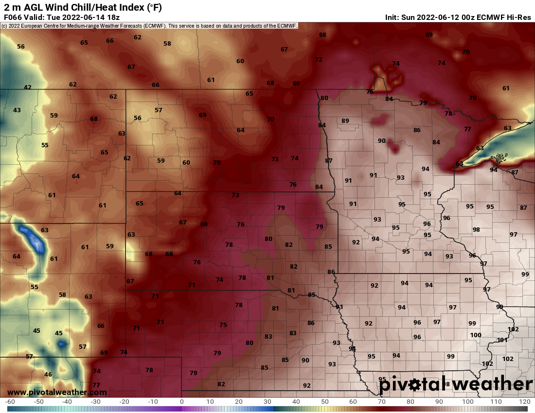
Tuesday, June 14th into Wednesday, June 15th
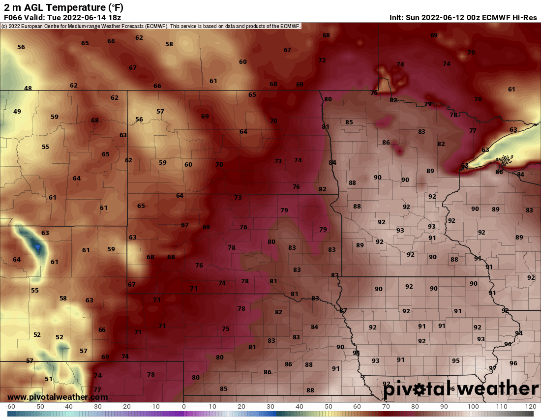
Another area of low pressure will lift across the region Tuesday across the Dakotas and into south-central Canada. As this area of low pressure tracks off to the northeast, a warm front will advance northward which is what will lead to the very warm temperatures and moist air to advect across the region on Tuesday. Below you will see the latest model guidance from the ECMWF model showing, temperatures forecast to be in the low to mid-90s, and the heat indices in the upper 90s nearing the low 100s.
These warm and moist conditions will be a sufficient amount of instability will be in place across the region, but once again, a strong cap will prevent these storms from developing for a large chunk of the day. By late in the evening Tuesday and into early Wednesday, a cold front is forecast to work across the region that is forecast to provide enough lift to trigger storms over the Dakotas and western Minnesota which will work east-southeasterly along and ahead of this front. With a sufficient amount of instability ahead of the front, these storms should be able to sustain themselves into the Twin Cities, but model guidance is struggling to come to an agreement on how these evolve as they work off to the east-southeast.
We will continue to monitor the threat of strong to severe weather over the coming days. Be sure to have a plan in place in case severe weather does develop, and remember to be weather aware!