National Weather Service confirms microburst responsible for Rosemount storm damage on Monday
ROSEMOUNT, MINNESOTA - Monday afternoon, intense storms worked across the Twin Cities region, with the first alerts for the southern Twin Cities coming around 2:42 PM when the National Weather Service in the Twin Cities issued a Special Weather Statement for portions of Dakota County for 30 MPH winds and penny sized hail. By 2:57 PM, the Special Weather Statement was upgraded to a Severe Thunderstorm Warning for 60 MPH winds and half-dollar-sized hail. That warning would later be upgraded to tennis ball-sized hail as the storm strengthened and tracked south of the Rosemount area. The National Weather Service in the Twin Cities reports that some of the most significant damage occurred near White Bear Lake, Rosemount, and Hudson, Wisconsin.
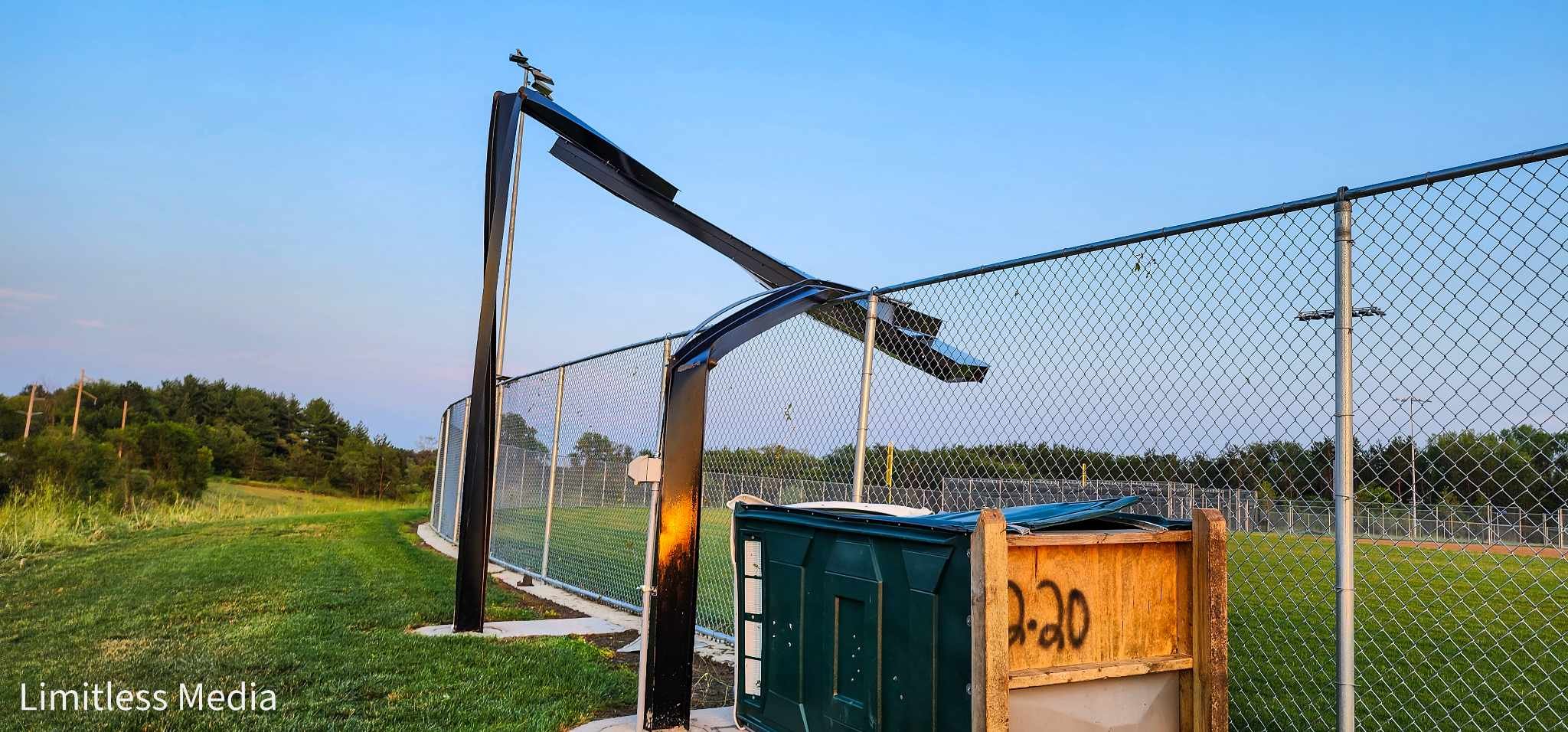
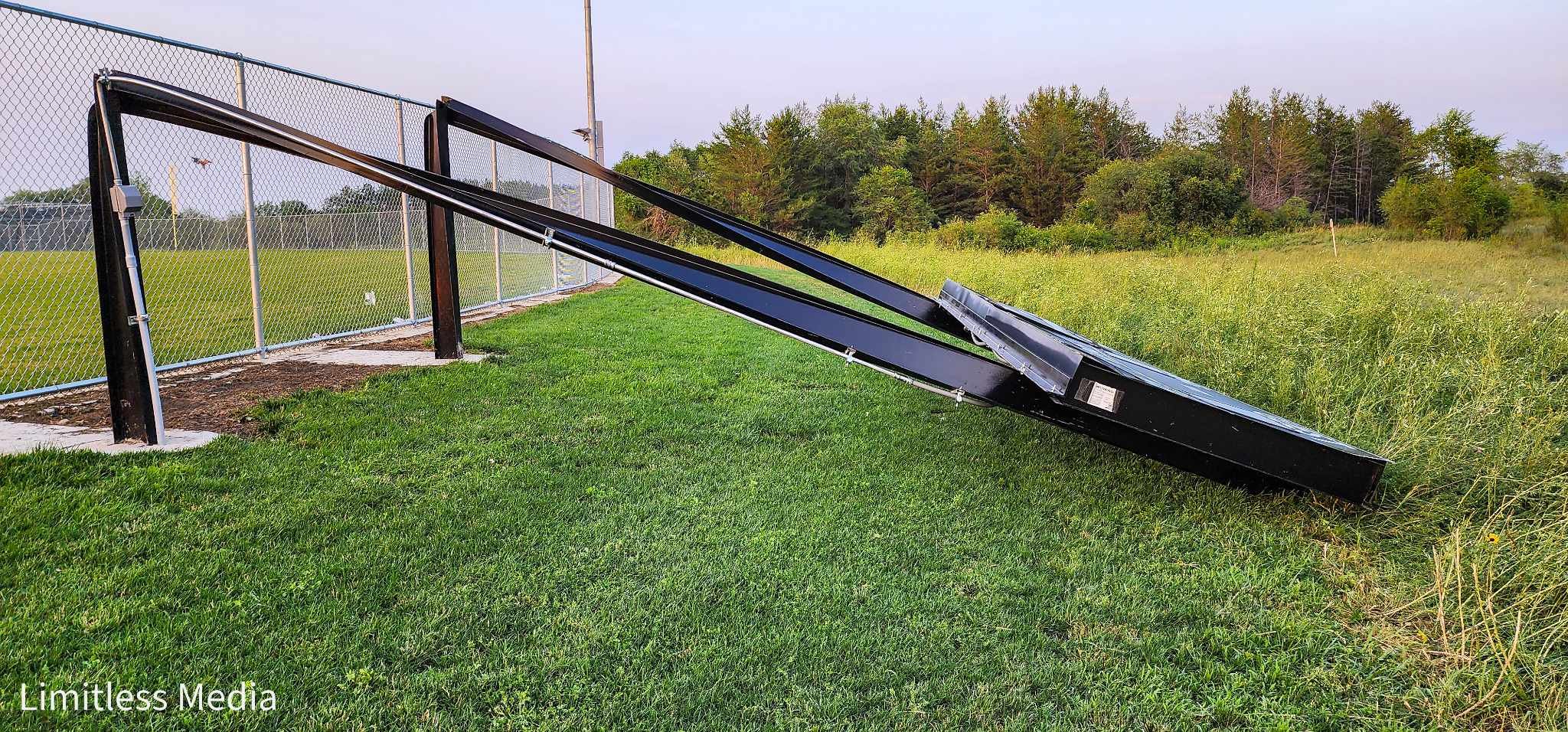
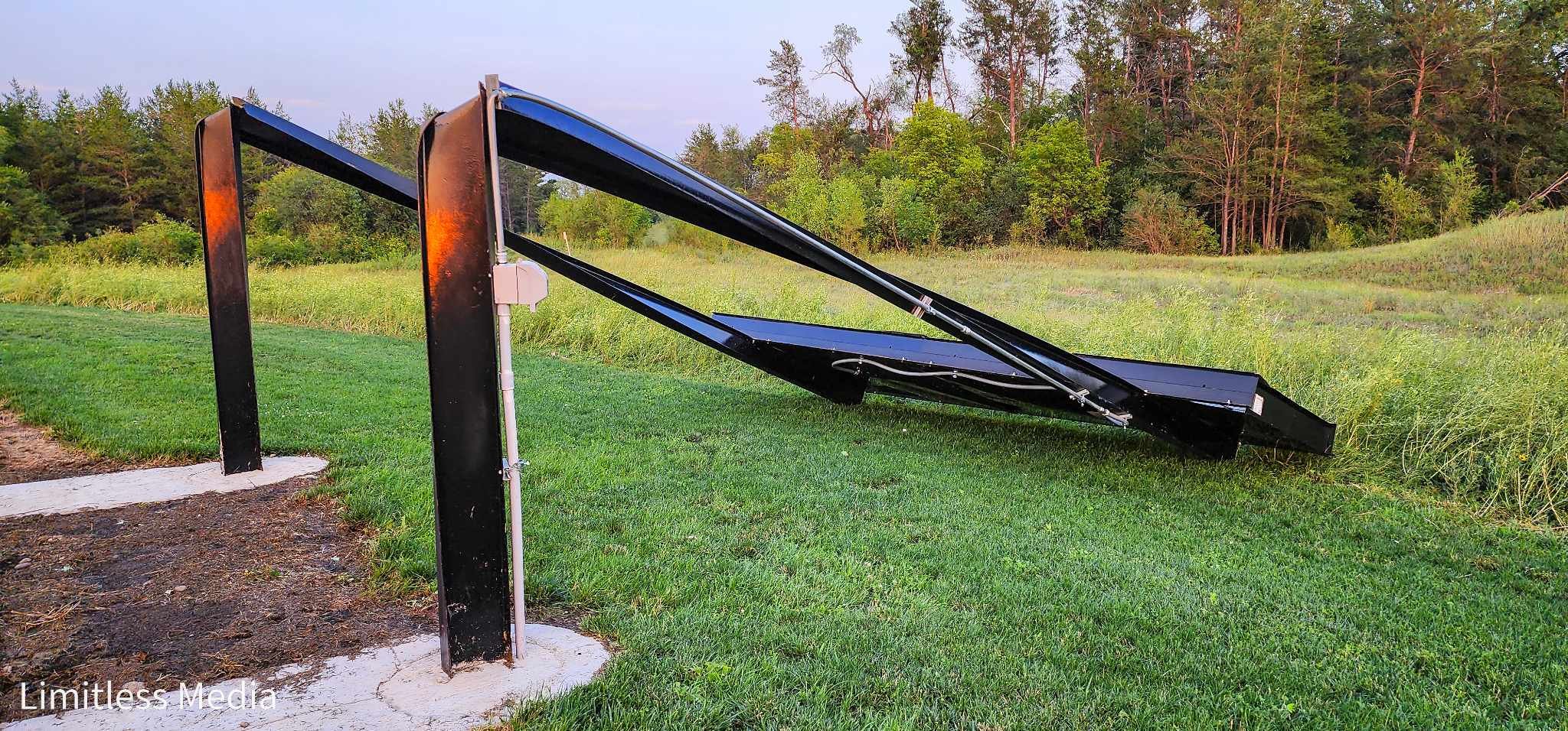
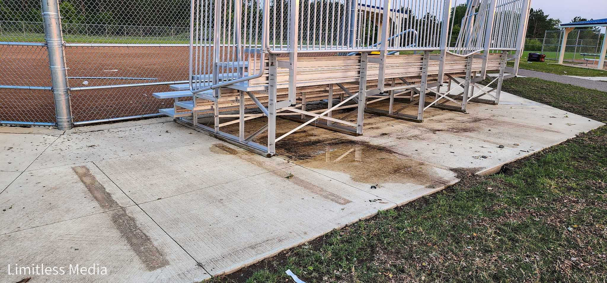
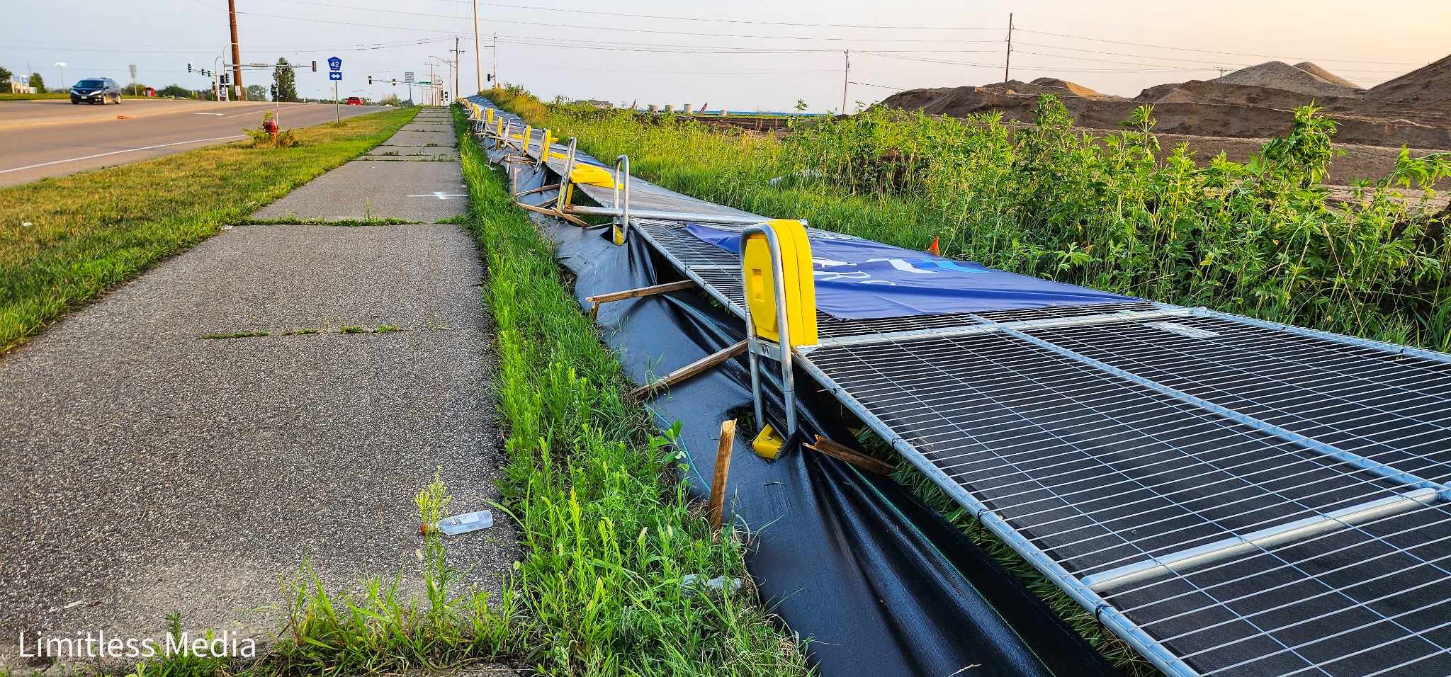
While covering the damage in the Rosemount, Minnesota area, an interesting damage pattern was beginning to come together. Some of the worst storm damage in Rosemount was at the Dakota County Technical College sports fields, where two scoreboards were bent over, and there was additional damage to bleachers and port-o-potties, which appeared to have been caused by winds blowing to the south. As you worked eastward across the campus, other tree damage appeared to be caused by winds blowing to the east or east-northeast. Adjacent to the Technical College, the entire fence around the work site was blown over in the large Roers Companies work site. While it doesn't take much to blow a metal fence over, it is essential to note that the damage north of 145th Street was all done by winds likely blowing to the north. Additional isolated damage was found in the neighborhood behind the work site, including snapped trees and trampolines.
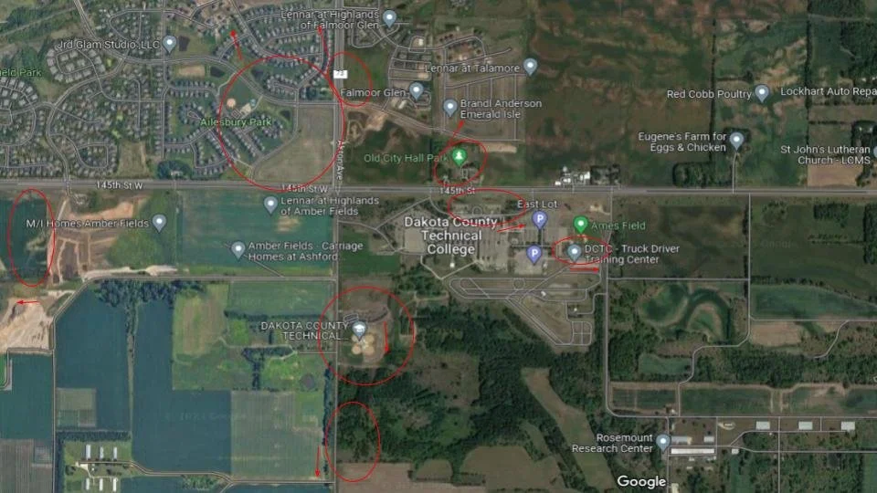
Rough map of storm damage locations in Rosemount with the wind direction that caused it.
This diverging pattern of damage from wind is an indicator of a possible Microburst. A wet microburst, often called a downburst, is a localized column of sinking air (downdraft) within a thunderstorm that is usually less than or equal to 2.5 miles in diameter. Wind speeds up to 100 mph are possible from microbursts.
After contacting the National Weather Service in the Twin Cities, they confirmed that the damage in the Rosemount area was likely due to a microburst. They estimated wind speeds were around 60 to 70 mph based on damage reports and radar velocity data.