Despite the recent rain, drought doesn't improve across Twin Cities

TWIN CITIES - According to the latest update that was issued from the U.S. Drought Monitor today, despite the heavy rain that was seen over the last few days across the Twin Cities Metro, drought conditions across the region did not improve. Across parts of the northern metro and into eastern Minnesota, the drought worsened.
According to the National Weather Service Twin Cities/Chanhassen, over the latest two weeks, the Twin Cities region saw less than 2 inches of rain, with even parts of the region seeing less than one inch of rain over the same period. Combine that lack of rain with the above to well above average temperatures, which only increases the rate of evaporation from area lakes, rivers, and streams, we are bound to see a worsening drought. While some locations did report seeing over 4 inches over the last couple of days, mostly in western Wisconsin, the overall impacts of that heavy rain were too isolated to make an impact on the overall widespread drought.
While we had a record winter for snow, that put us in a great place to start off the new year, since then, it has been abnormally dry. This is a major concern for not only the Twin Cities region but across the Midwest, since May through July are usually our wettest months and are vital in providing many farmers the precipitation they need to support their crops. While the drier pattern the region is seeing right now is abnormal for this time of year, when the ENSO climate pattern is factored into the mix, this abnormally dry weather pattern makes more sense. Earlier this year, the ENSO climate pattern changed from a rare three-year La Nina pattern to an El Nino weather pattern. During an El Nino climate pattern, the Pacific jet stream, which drives most weather that comes across the United States, shifts south across the southern United States
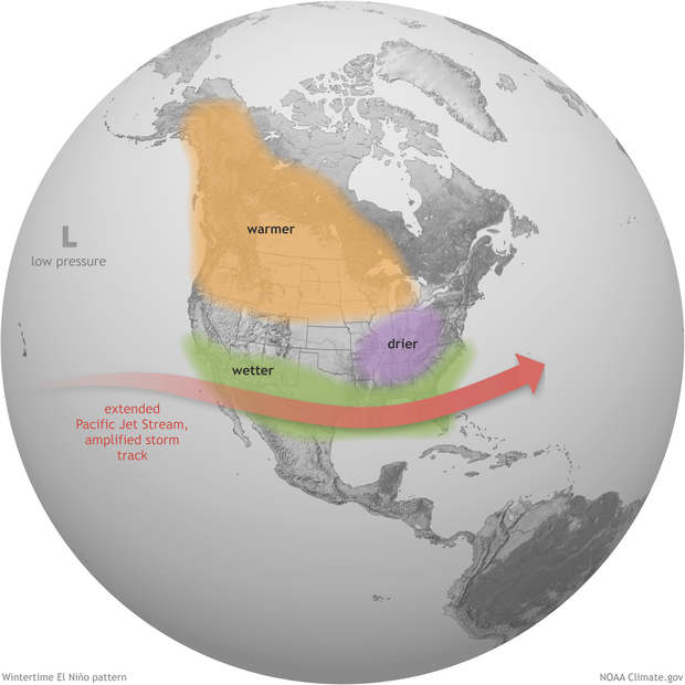
This usually leads to wetter than average conditions across the southern US and drier and warmer conditions across the northern US and Midwest. The key point to note is the ENSO pattern usually causes variations in the average weather pattern and is not the sole reason for extreme weather fluctuations. It is one piece in a much large puzzle that encompasses the planet as a whole. Thankfully for the state of Minnesota, the latest crop conditions as of July 2nd appear to be around fair to good, while across the border into Wisconsin, crops are beginning to suffer, with around 25% of crops now being reported to be around poor to very poor according to the latest update from the National Weather Service Twin Cities/Chanhassen.
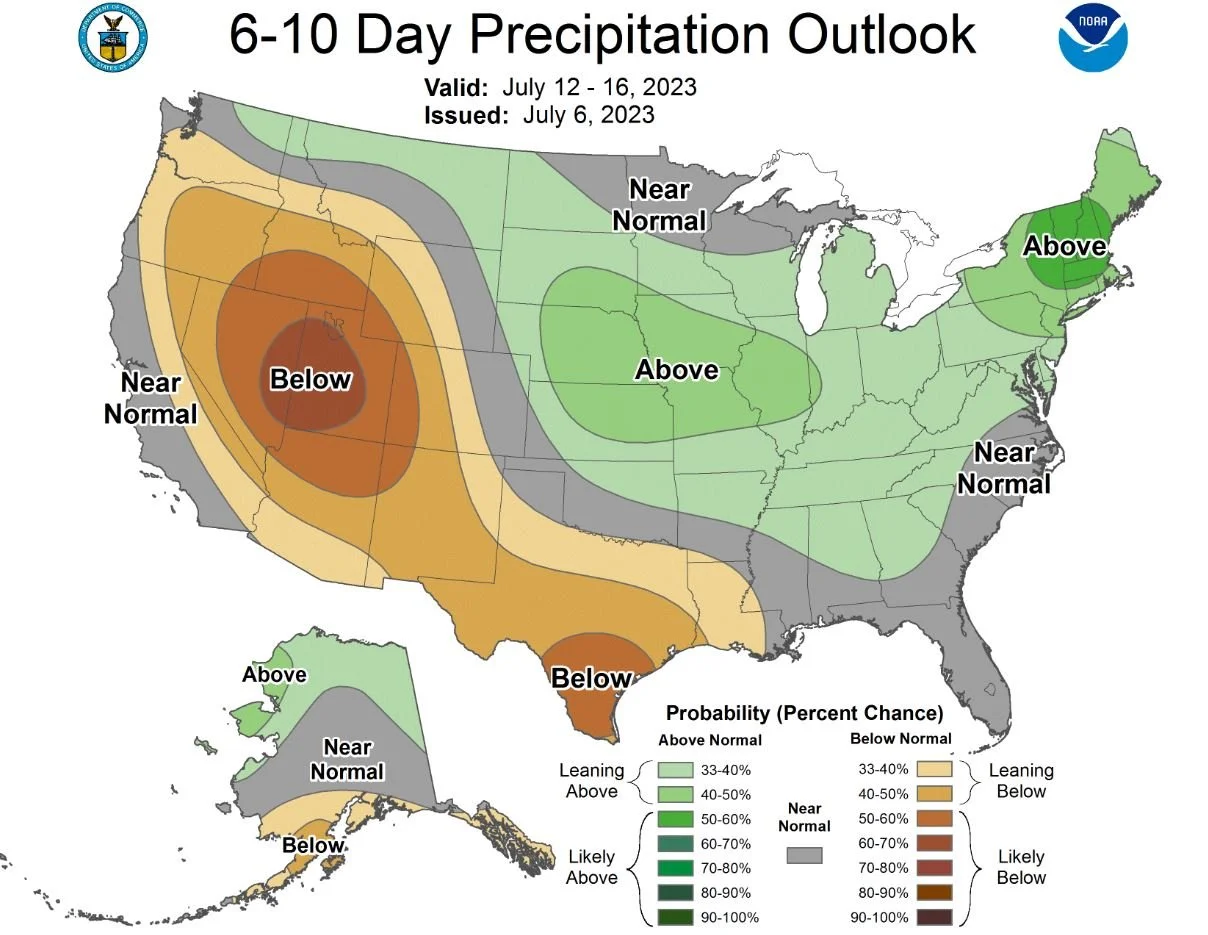
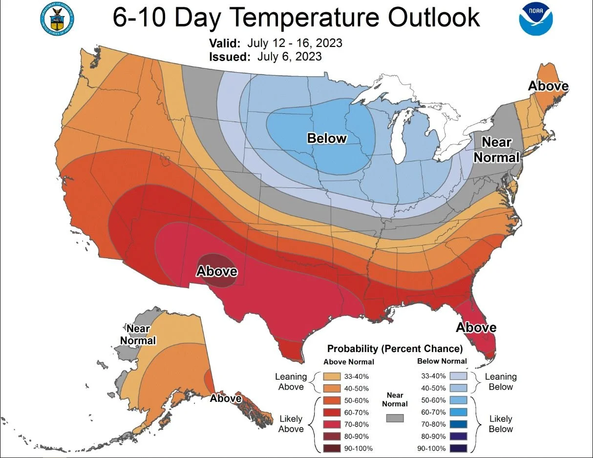
The latest 7-day precipitation forecast from the National Weather Service Twin Cities/Chanhassen has minimal relief coming to the Twin Cities region. When we look at the latest short-term climate outlook from the Climate Prediction Center, average temperatures are forecast to be below normal over the next 6-10 days with near to above-normal precipitation possible. While it is not completely known how that will impact the drought, yet, we can at least hope cooler temperatures and some increase in precipitation won't make the drought worse. The precipitation and temperature outlooks can be found below.