Tropical Storm Idalia is likely to become a major hurricane with its sights set on Florida
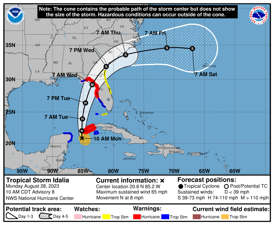
FLORIDA - All eyes are on Tropical Storm Idalia which is currently located about 120 miles southeast of Cancun, Mexico, and about 80 miles south of the western tip of Cuba. Tropical Storm Idalia currently has sustained winds around 65 mph with higher gusts and is expected to become a hurricane as it nears the western tip of Cuba later today.
The latest forecast has Idalia becoming a major hurricane just before landfall, with peak winds around 115 mph by early Wednesday morning following a period of rapid intensification possible beginning Tuesday. It is still too soon to pinpoint an exact landfall location, as minor shifts in the track could result in shifts in the landfall location, but the latest forecast has a landfall forecast between Apalachicola and Tampa Bay, Florida. Idalia looks to make landfall Wednesday morning as a possible Category 2-3 hurricane. The National Weather Service has just upgraded the Hurricane Watches to Hurricane warnings across these areas with Tropical Storm Watches now being upgraded to Tropical Storm Warnings from just south of Tampa to the lower Florida Keys where peak winds of 15-25 mph with gusts of 35 mph are currently forecast, but a shift in the track southward could result in potential for winds between 39 to 57 mph are possible.
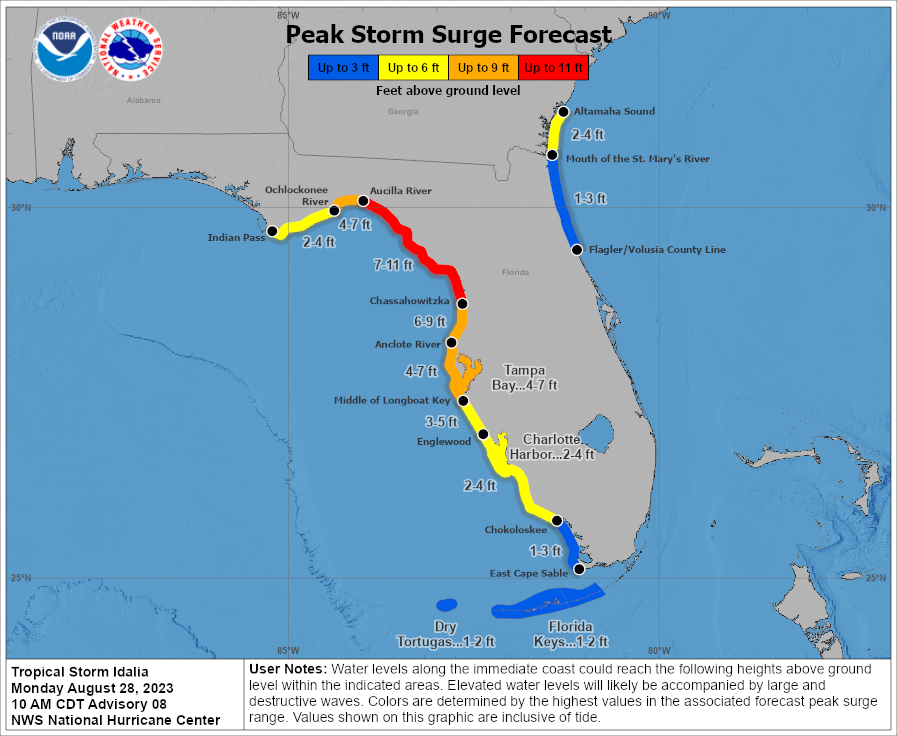
In addition to the winds, a significant storm surge threat is possible for areas in the direct path of the Idalia. The latest forecast has a storm surge of 7-11 foot storm surge forecast to be possible between the Aucilla River and Chassahowitzka, Florida, with a 4-7 foot storm surge that is possible for the Tampa Bay area. The highest storm surge is expected on the south and eastern sides of the tropical system, where winds will be wrapping around the storm counter-clockwise and pushing the water onshore.
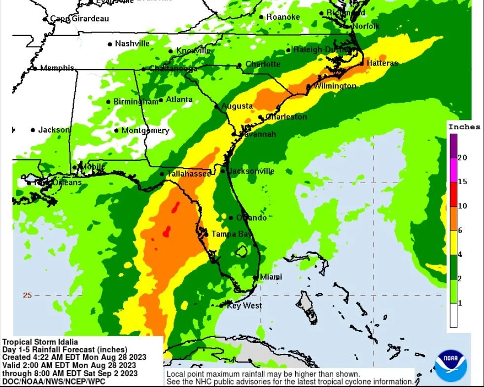
Heavy rain is likely across the Florida Panhandle, western Florida, southeast Georgia, and into the eastern Carolinas where 4 to 8 inches of rain is forecast to fall from Tuesday until Thursday. Isolated higher totals are possible near landfall in northern Florida. This could lead to flash flooding and urban flooding. You can see the latest forecast for rainfall below (as of late Monday morning, August 28th). A few tornadoes will also be possible along the west-central Florida coast beginning Tuesday and will shift northward through the evening hours on Tuesday.