
Midwest Severe Weather Threat Tuesday, October 11th
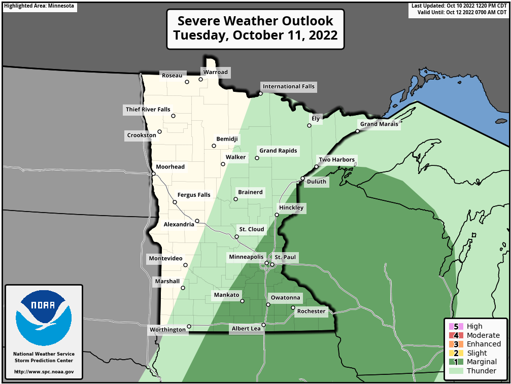
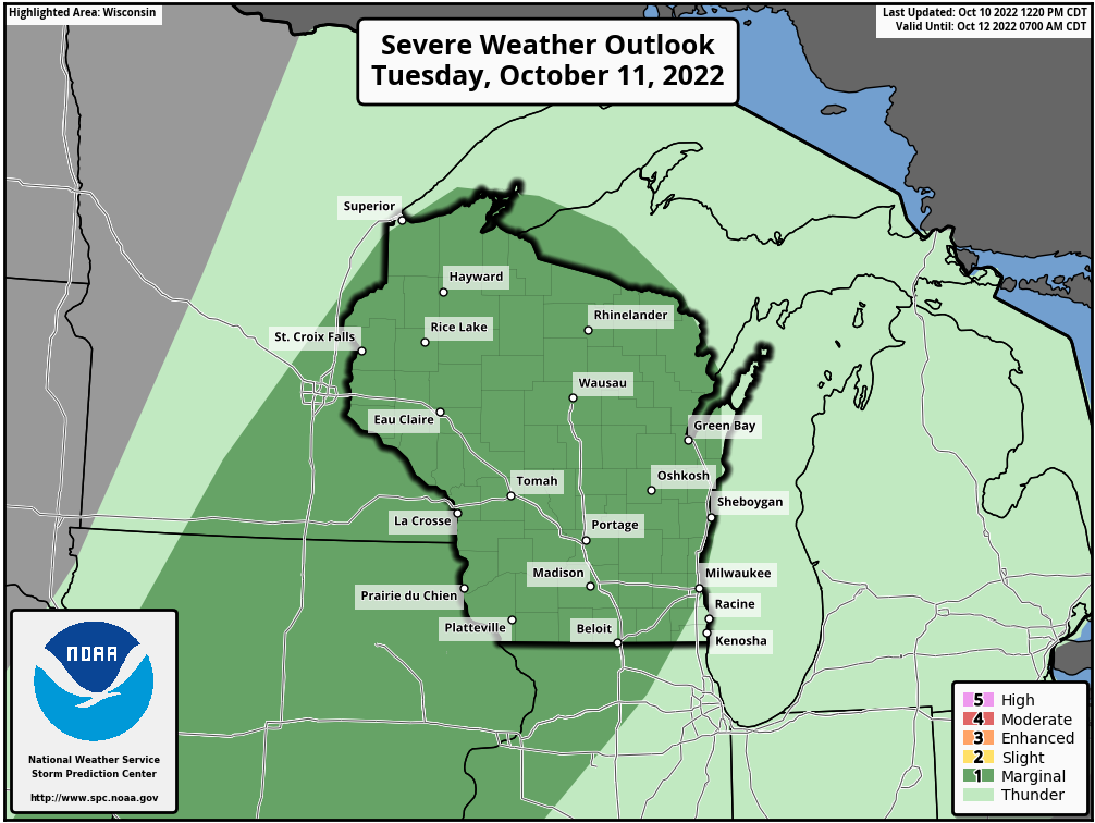
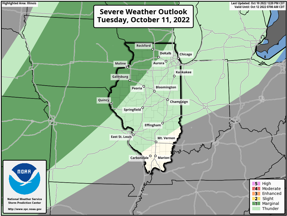
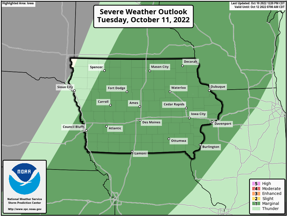
While it was chilly during the late evenings and early morning hours over the weekend, we have a return to more summer-like weather today and tomorrow (Tuesday) where the mid to upper 70s are likely across the Midwest with a few areas even making a run for the low 80s once again. With the heat though, comes more moisture and instability, which will help to fuel the threat of strong to potentially severe storms late Tuesday into early Wednesday morning across the Midwest. Above you will see the latest Severe Weather Outlooks from the Storm Prediction Center for tomorrow (Tuesday, October 11th) for Minnesota, Wisconsin, Illinois, and Iowa where a Marginal (1 out of 5) chance of severe weather is currently in place. We will have more on that severe threat below.
The Setup
A strong area of low pressure will work east across northern Manitoba, and as it does, a cold front will stretch south-southeast from the low pressure across the Northern and Central Plains. This cold front will progress off to the east-southeast over the next couple of days. Ahead of the cold front, warm, moist air will be advected northward across the Midwest. The warm air advection from the south is what will help much of the region surge into the middle 70s to low 80s on Tuesday, but will also add in the remaining two ingredients needed to help increase the instability across the region and fuel the potential for strong to severe storms Tuesday evening into early Wednesday morning.
As the cold front works across the region late Tuesday afternoon and into the early morning hours Wednesday, it will provide the lift needed to trigger the shower and storm potential along and just ahead of the front. Since the storm threat is late in the day Tuesday and into the early morning hours Wednesday, there won’t be as much instability for the storms to work with. Additionally, there is still some uncertainty between the models in regard to overall storm coverage and timing. This is the reason why there is a Marginal threat of strong to severe storms in place at this time. If models start to become more aligned and begin to highlight a chance of earlier storm development that could be surface-based, there is a chance there could be an upgrade in later updates for a greater chance of severe weather. This will be something we continue to monitor tonight into tomorrow.
The Threat and Timing
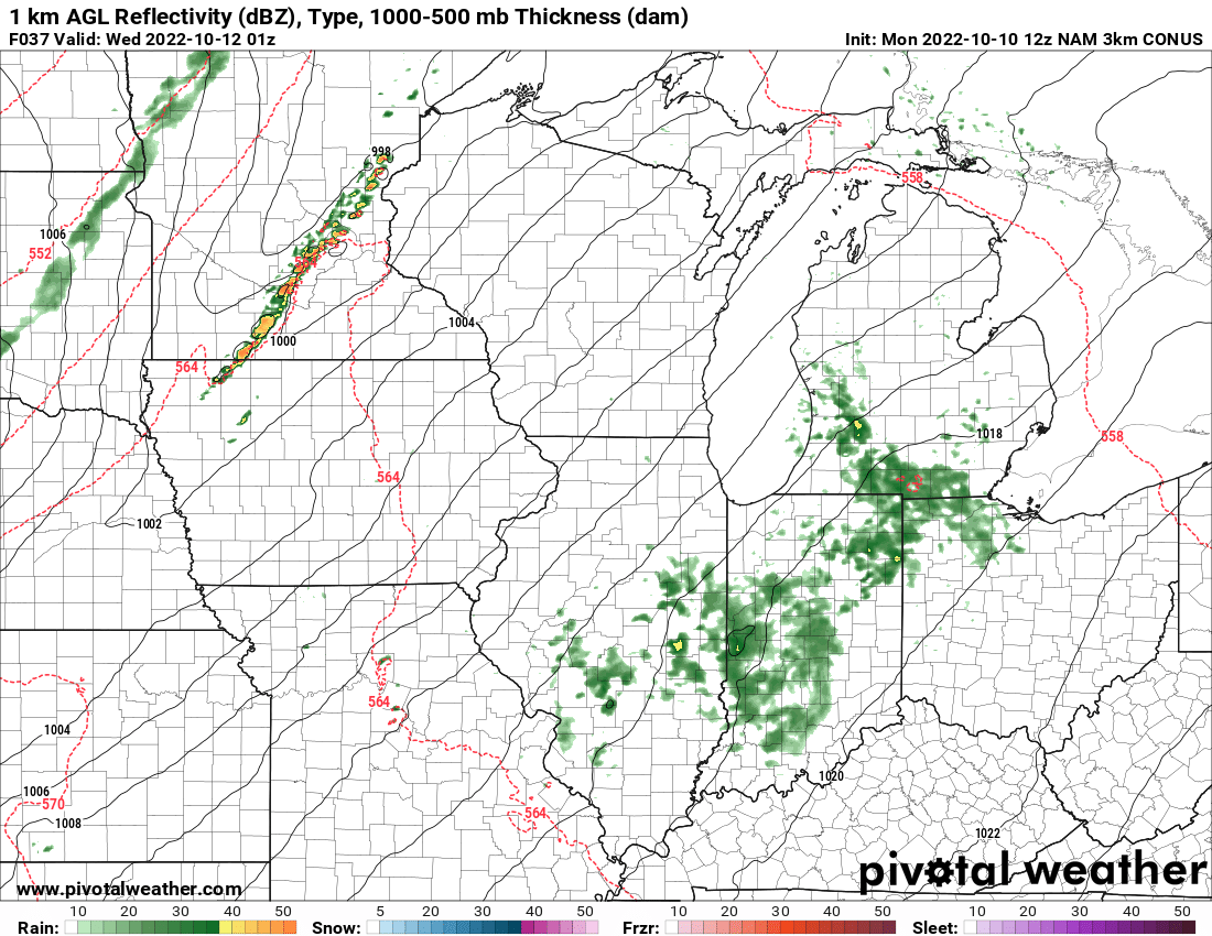
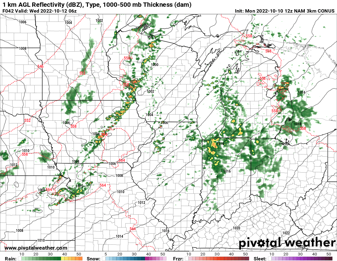
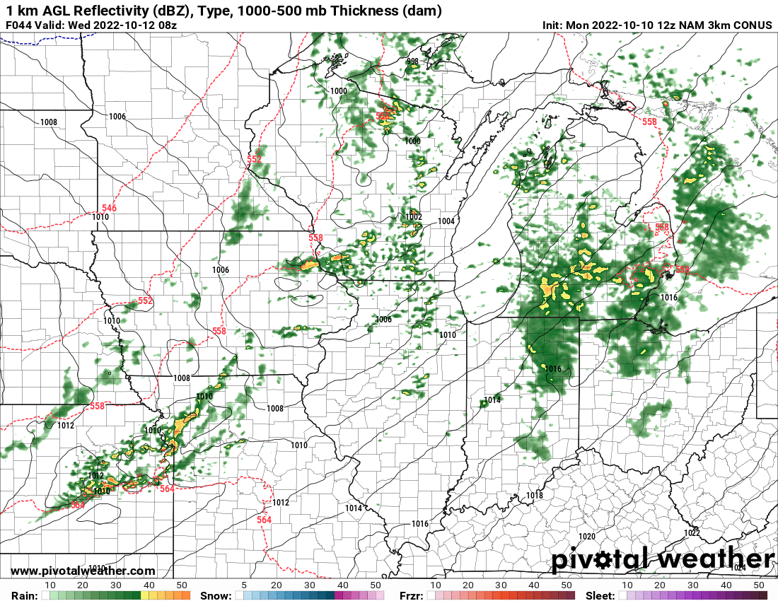
At this time, the greatest threat from these storms looks to be isolated large hail, but an isolated strong to severe wind gust can’t be ruled out from the strongest cells. If these storms can become more surface-based, there is a chance that the damaging wind threat could increase along and ahead of the line. According to the 12 UTC NAM 3 km model, storms look to initiate around 7-8 PM just to the west-northwest of the Twin Cities [first image below]. By around 1 AM, these showers and storms look to work into central Wisconsin and Iowa, though by this point it appears they are beginning to weaken as the amount of instability available looks to have really decreased [image #2]. After the 1 AM time frame additional isolated to scattered showers and storms look to be possible across southern Wisconsin to Northern Illinois through about 4-5 AM. While these do not appear to be severe by that point in time, locally enhanced winds gusts and small hail can’t be ruled out within any stronger cells that might develop [image #3].
Again, if these storms develop earlier in the day and can become more surface-based, there is a chance the threat of strong to severe storms would increase and that threat might even last longer as there could be just enough instability for a potential line of storms to sustain itself just a little more. This is something we will need to monitor as the day goes on tomorrow.
We will continue to monitor this threat of strong to severe weather, so be sure to check back for the latest updates and remember to be weather aware!