
Severe Thunderstorms and Intense Supercells Expected across Central Texas
Written by: Candyse Arivett
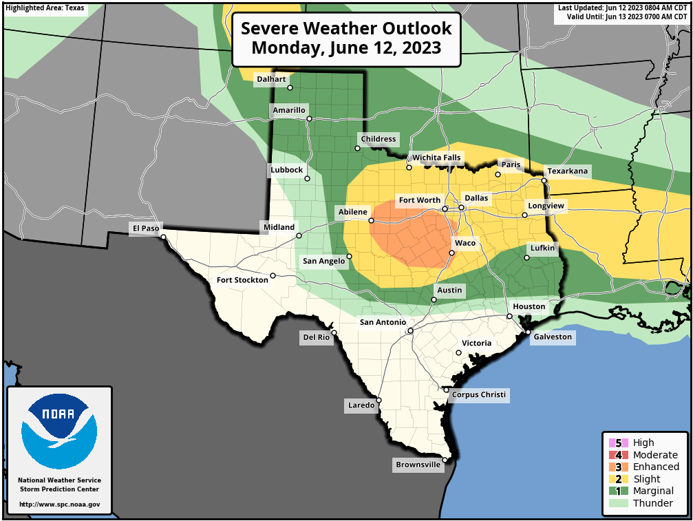
Surface cyclogenesis and changing atmospheric dynamics are setting the stage for potentially severe weather across the Edwards Plateau and central Texas today. With the influence of westerly winds and strong destabilization, the region is primed for the development of intense thunderstorms, including the formation of large, powerful supercells. These storms pose a threat of very large hail and the possibility of tornadoes, particularly near the triple point and areas of interaction with the west/east front.
As the upper ridge weakens and westerly winds strengthen, a triple point is anticipated to form near the west/east-oriented front. This convergence of weather systems will lead to the enhancement of mid/high-level westerly winds and an increase in effective shear, reaching around 50-60 kt. The resultant environment will support strong destabilization, especially south of the front and near the surface triple point, where the Mixed Layer Convective Available Potential Energy (MLCAPE) is forecasted to exceed 4000 J/kg.
The Texas Big Country and parts of the Low Rolling Plains will be the primary focus for intense thunderstorm development later this afternoon. It is expected that one or more large, intense supercells will form, characterized by their rotational structure and potential for severe weather. The main threats associated with these storms will be very large to potentially giant hail, posing a significant risk to property and vehicles. Additionally, the interaction of these storms with the west/east front increases the potential for tornado formation.
The storms are forecasted to persist as they move east-southeastward across the region throughout the evening. However, as the overnight hours approach, they are likely to weaken and diminish in intensity. Despite this, it is crucial to remain vigilant and stay updated on the latest weather information and warnings.
Given the potential for severe weather, it is essential to stay informed and take necessary precautions to ensure personal safety. Stay tuned to reliable weather sources for updates and heed any warnings or advisories issued by local authorities. Make sure you have a plan in place and are prepared for severe weather events, including seeking shelter in a sturdy structure when necessary.
Follow our social media accounts for the latest breaking news updates!