
Severe weather threat returns to the Twin Cities Wednesday; Recap on drought relief from this past weekend

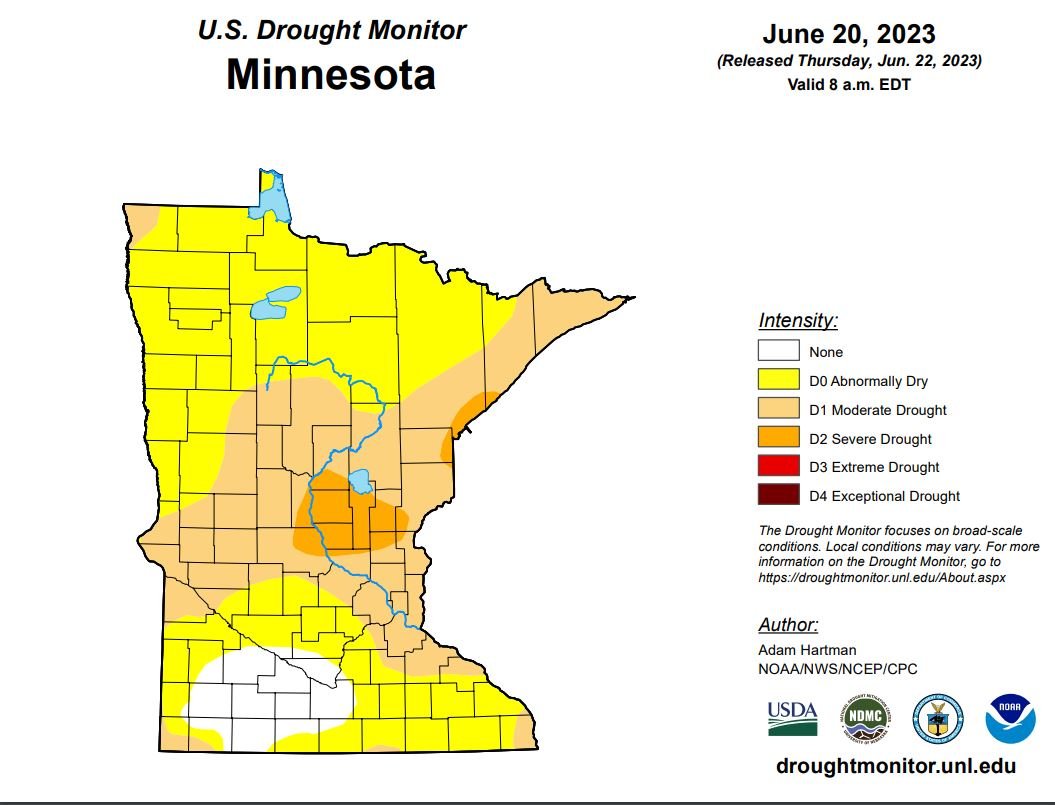
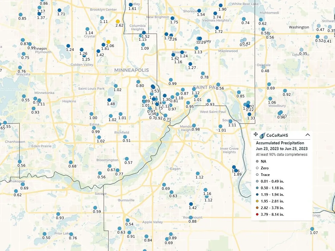
TWIN CITIES - The Twin Cities area saw some much-needed rain over the weekend, where 0.50 to upwards of 2.0 inches of rain fell across the Twin Cities region. According to the NWS Twin Cities based on observations at the Minneapolis-St Paul International Airport, for the year, that area is sitting just over 2.00 inches below normal for the year. This puts the region in an abnormally dry to moderate drought.
Looking forward to Wednesday, rain chances return for the region with the Storm Prediction Center even putting a Slight (2 out of 5) risk for severe weather. The latest forecast guidance has a cold front working across the region Wednesday afternoon and into Wednesday evening. Ahead of the front, warm, moist air will allow for an abundance of instability to build which will support the development of strong to severe storms along and just ahead of the cold front. The main threat from this activity will be large hail and damaging winds within the strongest storms, but there is an isolated threat of tornadoes as there will be just enough low-level wind shear to promote the tornado threat for any isolated long-lived storms that might develop. There does remain some uncertainty on storm coverage for Wednesday, which could impact the severe threat some, but those details will likely be ironed out over the next day or so.
On the precipitation side of things, depending on where the heaviest of the showers and storms develop and if there is any training of storms over an area, precipitation totals look to range between 0.25 to 0.60 inches, but locally higher amounts are definitely possible. While that doesn't seem like a lot, every little bit counts when trying to slowly dig ourselves out of a slight drought.
Adjustments to the severe threat and precipitation amounts are likely over the next couple of days, but be sure to check back for the latest weather updates.